About
The District
In July, 1987, the Circuit Court of St. Louis County approved the formation of the Howard Bend Levee District pursuant to the petition of the owners of a majority of the land within the District. The District was initially created for a period of 100 years. The District is governed by a Board of Supervisors who are five in number and one of whom is elected each August for a term of five years at the District’s annual meeting of landowners. The Board is responsible for construction and maintenance of the District’s entire flood protection system and meets monthly to review contract or easement issues and consider invoices and other business.
The current members of the Board of Supervisors and the expiration of their terms of office are:
| Edward Ortmann | August 2025 |
| Ken Franklin | August 2023 |
| Jim Carver | August 2026 |
| Brian Schaffer | August 2024 |
| Michael Towerman | August 2027 |
The Board of Supervisors establishes the annual assessment rates in August of each year as required by Missouri statute. Separate installment rates are set to defray the cost of principal and interest payments owed under bonds issued by the District to finance construction of the improvements necessary to provide flood protection and water and sewer services. Another rate is set for the maintenance assessments necessary for the annual operating expenses of the District. These assessments are a lien on property until paid and accrue interest at the rate of 1% per month if not paid by December 31 of the year due.
Our History
Howard bend
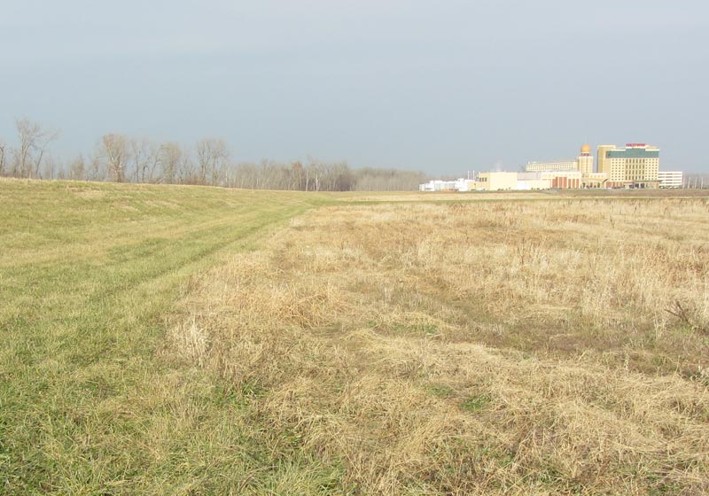
Prior to 1987 the District area was largely protected by an agricultural levee maintained by the Howard Bend Levee Association. Gradual improvements to the flood protection system began to be made shortly after the formation of the District in 1987. When several companies sought to locate casino gaming facilities in the District in the mid-1990s the District determined that major improvements to the flood protection system were necessary and could be financed without unreasonable burden to the landowners. In 1997, the District was thus able to initiate major flood protection improvements in conjunction with the opening of the Hollywood Casino and Hotel in the District. Over a period of several years nearly four million cubic yards of levee material were moved into place creating the levee and underseepage berm system for the District along the Missouri River. This system was designed and constructed under the direction of the District’s engineers at Horner & Shifrin, a firm particularly well experienced in levee construction, having previously designed and overseen construction of the nearby Earth City levee and flood protection system.
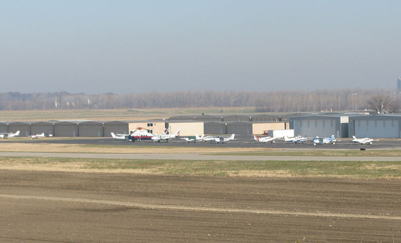
Construction of the 500 year levee was completed in 2004 and a FEMA letter of Map Revision dated April, 13, 2006 determined that most of the property in the District is not flood plain and may be developed for commercial, industrial or residential uses subject to the land use regulations of the City of Maryland Heights or Chesterfield and qualifies for federal flood insurance. This flood protected status is reflected in the major expansion of the Metropolitan St. Louis Sewer District plant within the District and further development at Creve Coeur Airport relying on this greatly improved flood protection. The District has also recently completed the installation of Missouri American water lines and Metropolitan St. Louis Sewer District sanitary sewer lines and pump stations in a portion of the District in order to serve existing and future land uses.
About
Levee System & Flood Protection
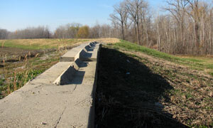
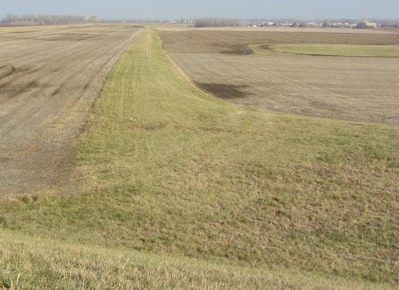
The Missouri River flood protection system has been constructed to an elevation at least three feet over the level of the 500 year flood as determined by the joint efforts of the U.S. Corps of Engineers and the Federal Emergency Management Agency. In conjunction with this levee an underseepage protection berm was also constructed to prevent the undermining of the levee by the water pressure of a high water condition on the unprotected side of the levee along the river. This berm is generally 300 feet wide and up to as eight feet thick as necessary based on engineering determinations and soil tests.
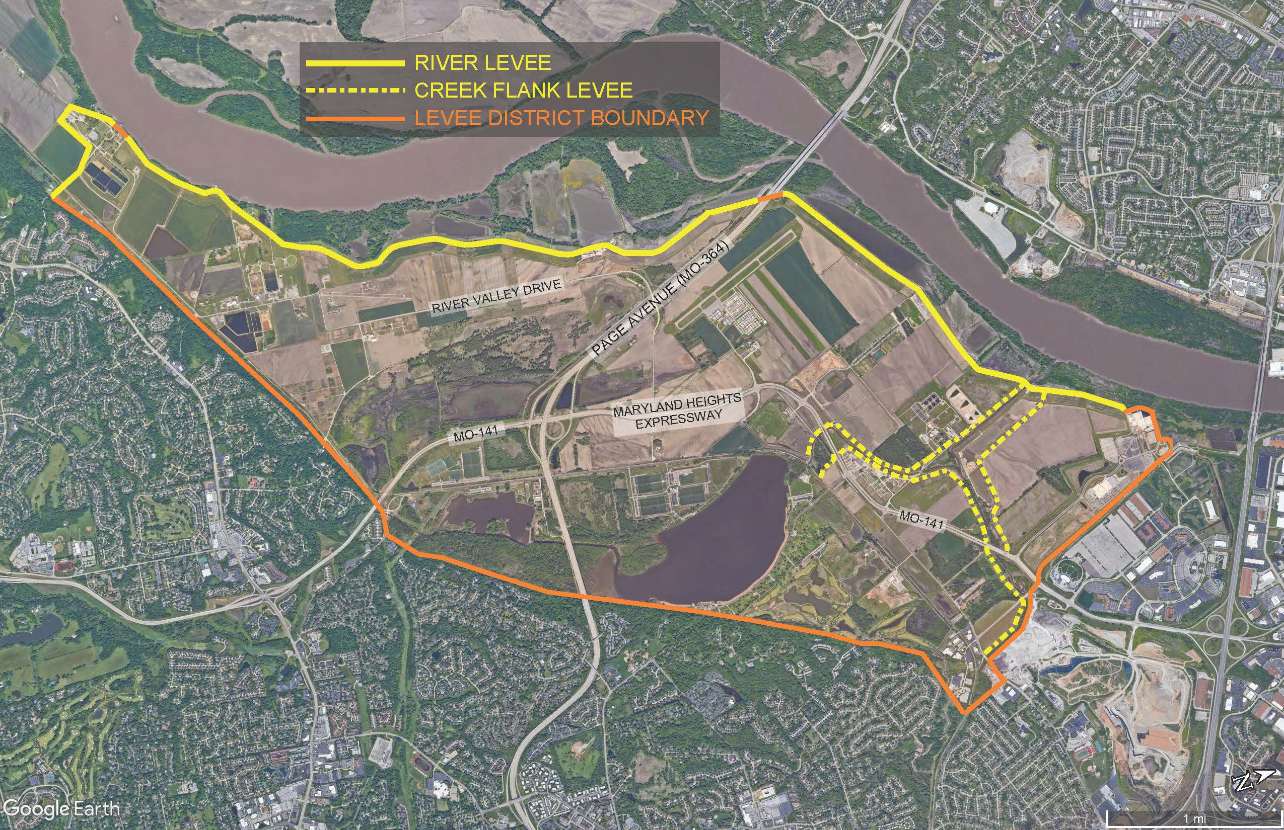
The District extends along the Missouri River for seven miles from its attachment to the Riverport levee at river mile 28 in City of Maryland Heights to its connection to the Missouri levee bluffs at river mile 35 in the City of Chesterfield. The flood protection system also includes levees along Creve Coeur Creek and Fee Fee Creek which course through the District creating the spectacular feature of Creve Coeur Lake located in Creve Coeur Lake Memorial Park.
Following completion of the Missouri River levee it was thoroughly reviewed by FEMA and the flood plain maps for the District were substantially revised to reflect that the Missouri River flood risk was reduced to a level permitting most of the area to be used for commercial, industrial or residential purposes in accordance with the land use plans of the governing cities. The District has also been accepted into FEMA’s PL 84-99 program which permits the District to receive reimbursement for most costs associated with flood fighting during high river levels in a major high water event. Major repairs of the flood protection system also could qualify for significant cost reimbursement under this program.
The District Engineer has developed a detailed Operations Manual to control the routine and emergency efforts of District personnel. Regular maintenance and readiness operations are conducted by the Maintenance Supervisor of the District in coordination with the Corps of Engineers and the District Engineer. These efforts prepare the District to respond to high water or flood conditions in a timely, efficient and effective manner.
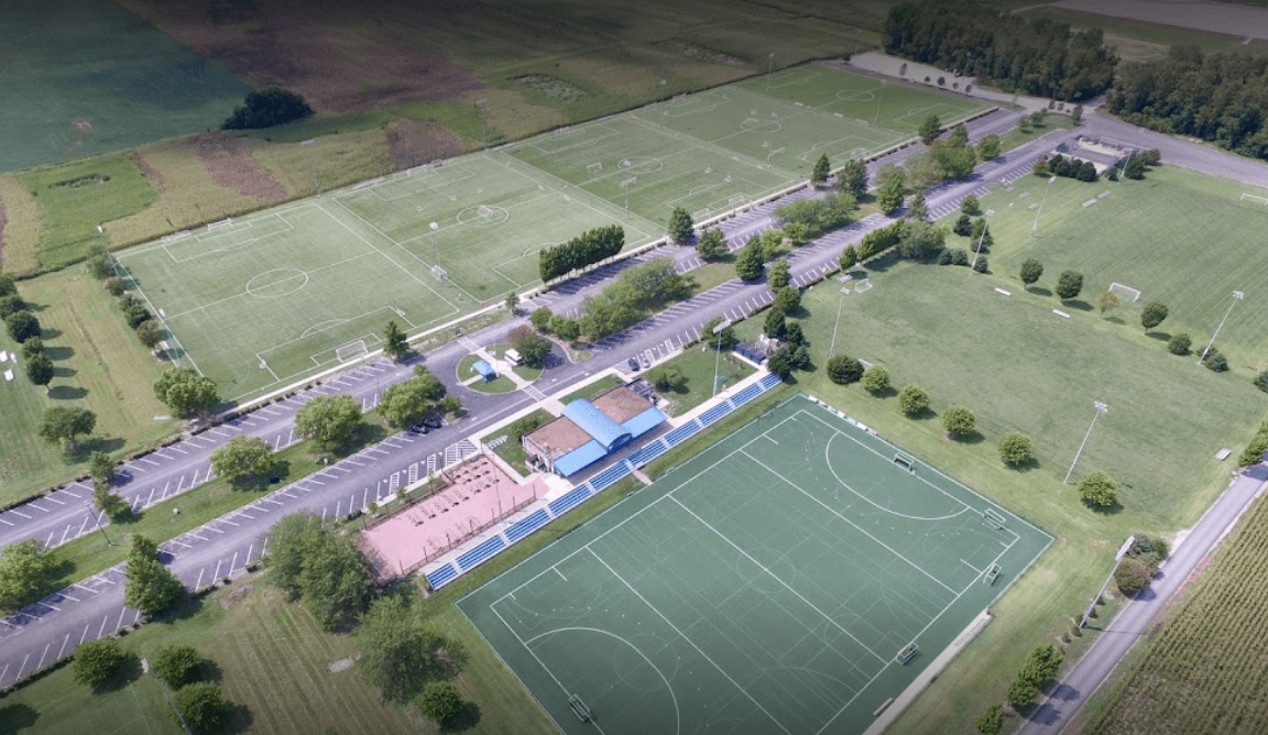
Multiple Site Opportunities
Boundary Map